Alert
June 20-21, 2026: Bridge replacement work requiring closure of the trail section east of MacLean Drive.
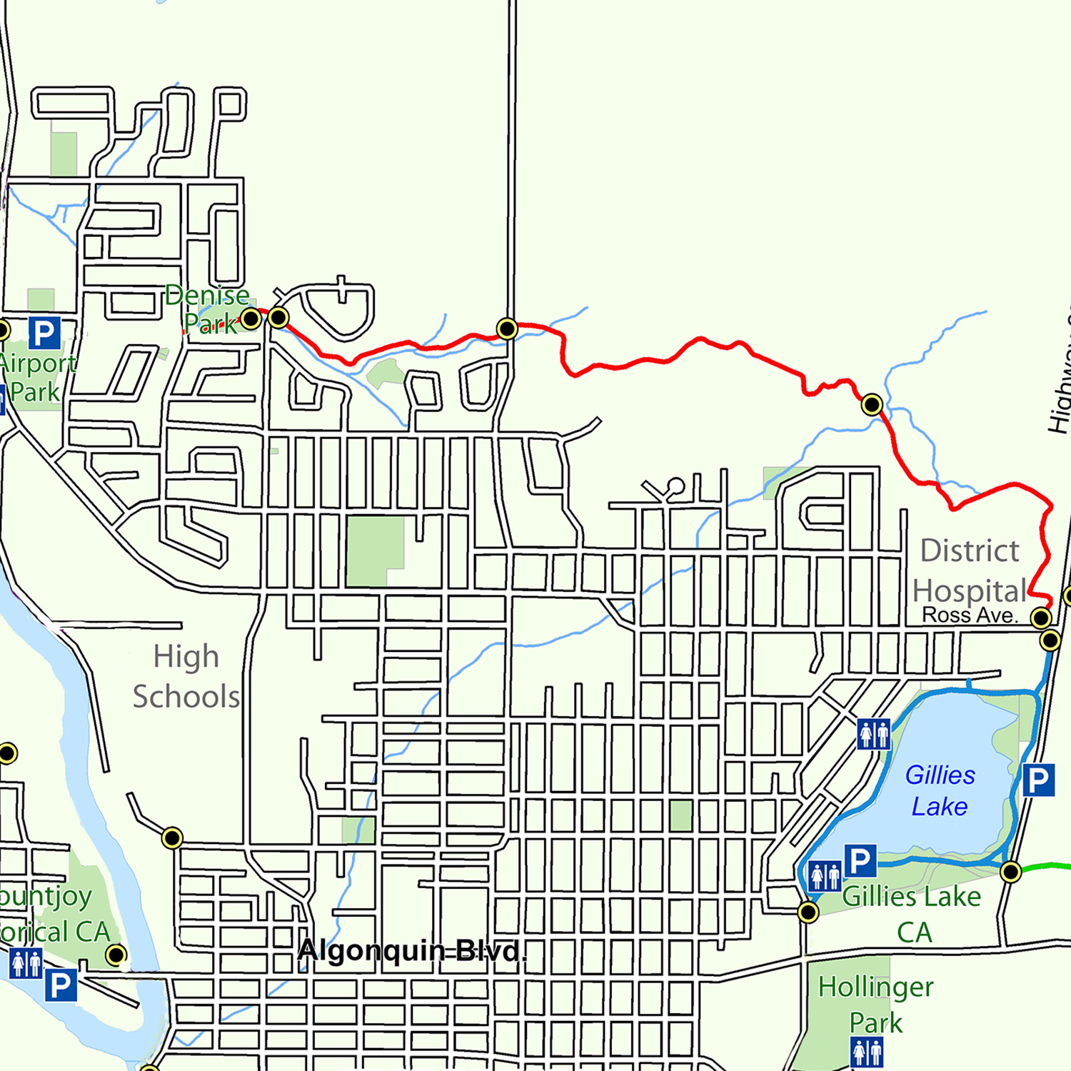
The Scout Rock Trail was the first to be fully incorporated into a residential area. It joins with the Gillies Lake Promenade and Golden Springs Trail at the corner of Hwy 655 and Ross Avenue East and provides easy access to the entire trail system for those living in the north end of the city. All along the trail are many rare and interesting plants that are not usually found this far north. Scout Rock itself makes for spectacular viewing of many parts if the city. Although a section of the original trail was cut off during the construction of the Timmins and District Hospital, the 4 km trail was fully reinstated in 1995.
Trail Description
Starting at the trailhead at the corner of Highway 655 and Ross Avenue East, the trail winds its way across the hospital site to the back parking lot adjacent the original Scout Rock bedrock outcropping. From here, it enters the forest and descends a steep hill to where it merges with an old trail heading in a westerly direction. After approximately 300 m, the trail swings to the north and passes through a marshy area until it reaches the headwaters of Town Creek and the Town Creek Portage. At this point, one will have to cross two bridges as the trail continues to rise to higher ground. Continuing due west, the trail once again crosses over several bedrock outcrops and a large rock mound until it reaches MacLean Crossing. On the other side of the road and just to the south, the trail again continue to make its way to the west as it follows along a small valley referred to as the Melrose Ravine. Many plants and wildlife can be seen along this trail that call this area their home. Eventually, the trail emerges at the College Crossing. From here, it continues on to the other side of the road into Denise Park.
Highlights
- Moving from east to west, the trailhead marks the first section of trail as it passes through the hospital property. This area of exposed bedrock with its quartz veins was, at one time, thought to hold the same gold deposits that led to the development of the McIntyre and Hollinger mines.
- The Town Creek Portage is where the trail descends from the heights of Scout Rock and into a low-lying area that forms the headwaters of Town Creek. This area is rich in a variety of plants, birds and animals. Abundant water and vegetation also make this section of trail an ideal spot for observing beaver in their natural habitat. Town Creek drains as far east as the McIntyre tailings and eventually empties into the Mattagami River to the west.
- Up until the trail reaches the Melrose Ravine at the MacLean Crossing, the terrain is made up of bedrock outcrops and very shallow soils abundant with black spruce and thick mosses. At various locations, you will see straight lines cut through the bush. These cleared lines are used either by land surveyors to define property boundaries or by geologists looking for mineral deposits.
- The last third of the trail descends into the Melrose Ravine, a mixed hardwood forest that, because of its sheltered location, is home to many species of plants unique to this part of the province. Be sure to take a field guide along with you so you can identify the many plants. Trail corridors such as these are important in designing our urban areas because they provide shelter and habitat for birds and animals. The trail eventually emerges at College Crossing and continue on to Denise Park (owned and operated by the City of Timmins).
Trail Maps
Georeferenced maps are available to download on our trail maps page. Pocket maps are available at the MRCA office.