Throughout the winter months, MRCA staff manually conduct snow surveys twice a month, as near to the 1st and 15th of the month as possible. Snow courses are permanent locations that consist of 10 sample points over a distance of approximately 1 km. Sampling points are generally openings in wooded areas that are protected from wind drifting. Measurements are taken at two locations (Mountjoy and Porcupine) for snow depth and water content.
Snow depth is measured at each sample point with a calibrated snow core tube. The tube shows the depth measurement and removes a snow sample. That sample is then weighed to determine the snow water equivalent. An average of each sample point throughout the course location is calculated and recorded for each site. Please note that snow conditions can change rapidly and the snow survey measurements are only valid at the time of the measurement.
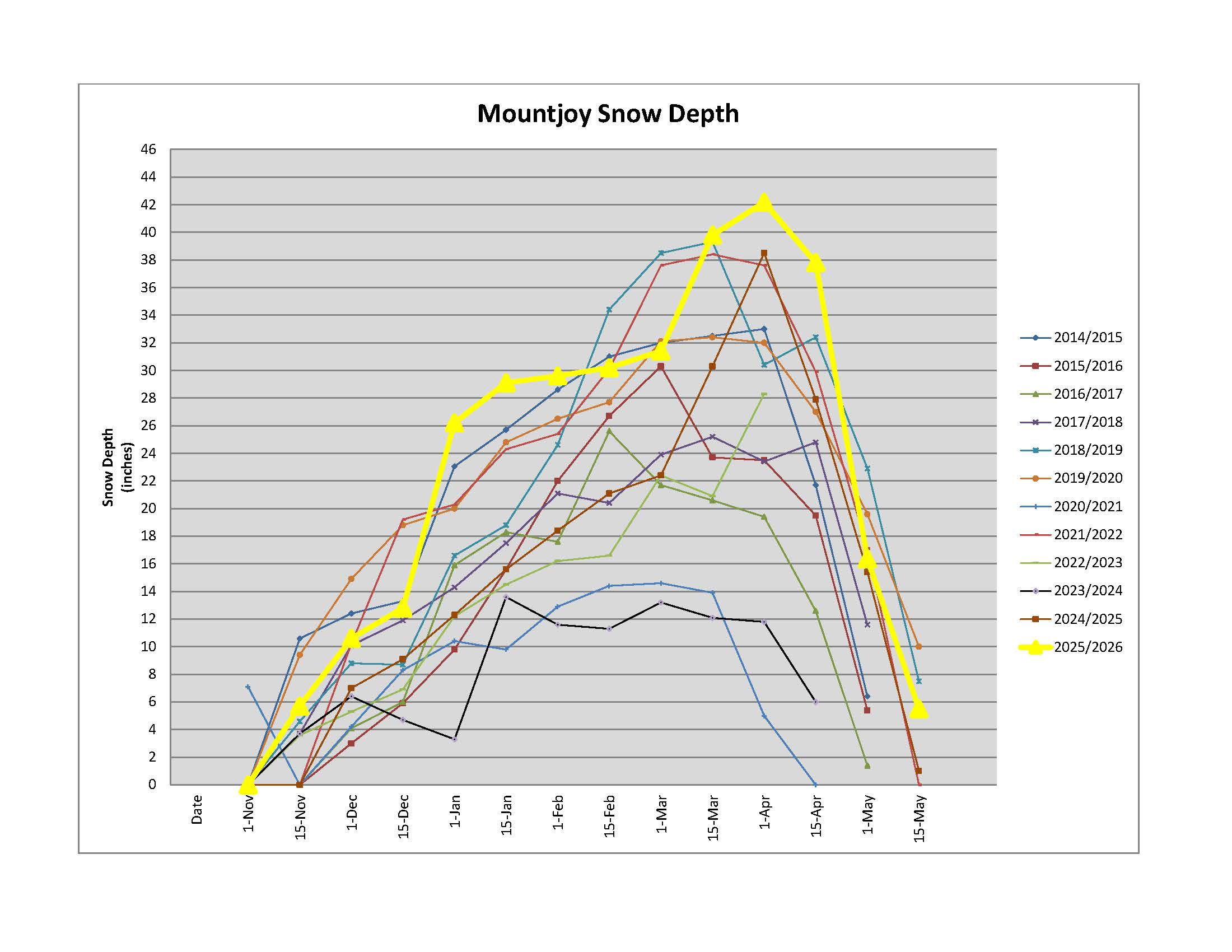
Mountjoy Snow Depth Chart
Snow site data as of May 13, 2026
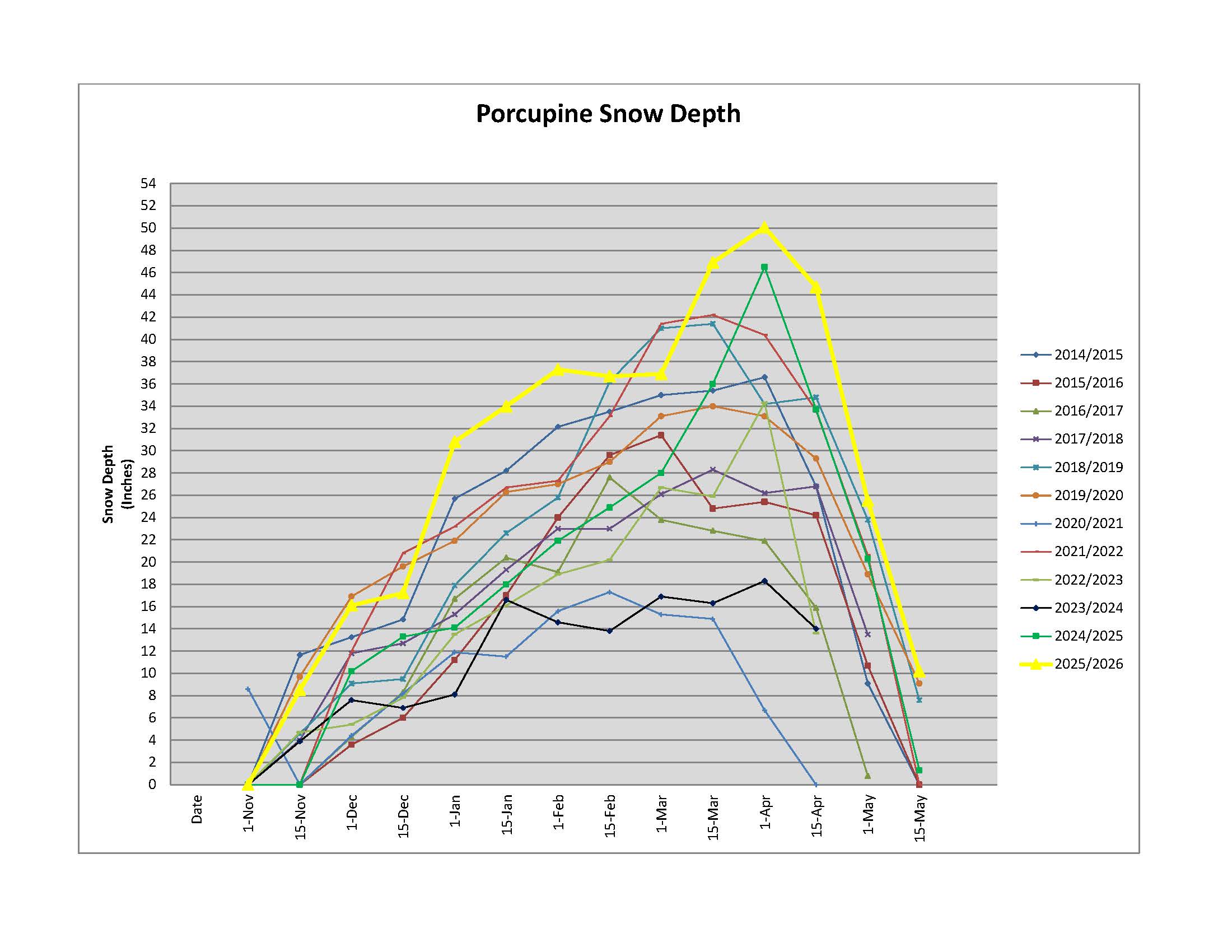
Porcupine Snow Depth Chart
Snow data as of May 13, 2026
*Note: The MRCA provides this data for general informational purposes only and assumes no responsibility for the correctness of the information nor liability to any user of the information regardless of purpose.