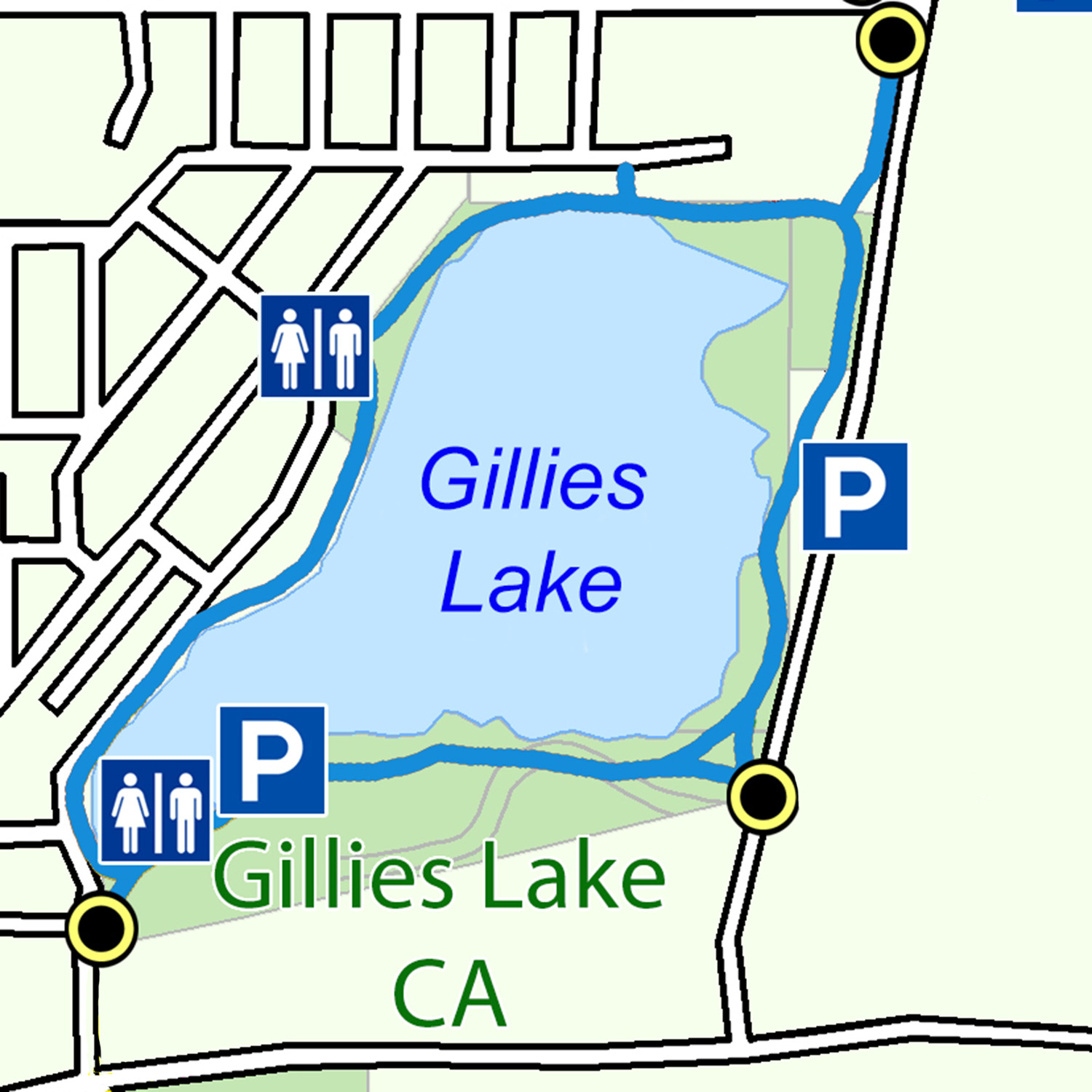
The most popular recreation trail in the community is the Gillies Lake Promenade, developed by the Conservation Authority as part of its lake rejuvenation project in 1986. Since that time, the 2.5 km trail has become the focus for the entire community trail network with direct linkages to the Scout Rock, Golden Springs, and Lion’s Walk Trails. The Gillies Lake Conservation Area offers the visitor a variety of things to do and see in a unique urban wilderness setting. It has parking, public washrooms, a beach and picnic facilities.
Trail Description
The Gillies Lake Promenade is best accessed from the main parking area at the south end of the lake next to the Conservation Authority office. Additional parking is available on the east side off Highway 655 and at the Toke Street park. The trail is lit year-round making it available for use early in the morning and late into the evening. The looped trail goes through a parkland setting and has benches, picnic tables and other outdoor facilities. The Authority has placed interpretive storyboards along the trail so trail users can learn a little more about the area’s natural history. Duck boxes, shrubs and trees have been placed in the area as habitat for a variety of wildlife. The Boardwalk offers park users a trail that is located entirely within the conservation area.
Highlights
- At the turn of the century before the large gold deposits of the Porcupine Camp were discovered, Gillies Lake was a pristine, 100-hectare spring-fed lake. As the area developed and the mines began processing the gold ore, the lake became a convenient natural basin to dispose of the mine tailings. By the 1940’s three quarters of the lake had disappeared and several headframes dotted the horizon. The Authority office marks the spot where one of the smaller mines, the Gillies Lake Mine, once stood.
- A major rejuvenation of the area took place in 1985 when the Conservation Authority acquired the lake, removed over 150,000 cubic metres of organic material from the bottom and landscaped the shoreline. Since that time the lake’s water quality has improved remarkably, turning the area into a popular recreational resource.
- Proceeding along the trail to the east you will notice one of two large ponds that were built next to the lake to collect the sediment contained in the runoff coming from the surrounding roads and storm sewers. These ponds ensure that the high quality of the water in the lake is maintained.
- The large hill you have to climb as you make your way east is the remains of the Hollinger Compressor Plant. This former building housed large diesel engines that supplied compressed air to the underground up until 1968. Because the diesels used lake water for cooling purposes, this portion of Gillies was kept ice-free right through the winter making it a popular year-round swimming hole.
- The entire eastern shoreline of the lake was at one time open water. What you are walking on now are layers of tailings, organics and construction debris from old downtown Timmins. This was all covered with a layer of clay and topsoil, covered with grass and planted with trees.
- Most of the lake’s shoreline has now become home to a variety of ducks and nesting birds including common loons, red-winged blackbirds and mallards. The lake is also a stopover for Canada geese and the occasional golden eagle. The rare white pelican has even made a brief visit. Duck boxes and nests have been built along the north shore of the lake to encourage some of these birds to spend the summer.
- Once you emerge from behind the houses you will come upon a yellow outlet structure constructed by the Authority to regulate lake levels. When the lake was filled in with tailings, its natural outlet to the Porcupine River was blocked. So that the lake would not flood, an outlet and storm sewer were put in place to drain the water into Town Creek and eventually the Mattagami River.
- The last portion of the trail will take you along the Boardwalk and back to the Authority offices. The Boardwalk was made possible through the considerable fundraising efforts of the Wintergreen Fund for Conservation and tremendous community support.
Trail Maps
Georeferenced maps are available to download on our trail maps page. Pocket maps are available at the MRCA office.